


Coconetla Ravine: an amazing spot at Los Dinamos Natural Park in Mexico City
Hills and cliffs, forest and river are located together where the Coconetla Ravine is born, where the Magdalena River flows, the last living river in Mexico City...

At the end of las year, Oscar, my younger brother, told me the following weekend he would visit Los Dinamos, a natural park in Mexico City, with a group of friends. I had heard many times about that place but had never visited it. It seemed interesting to me to join that tour because in that park is the only living river in the city: the Magdalena River.
This natural park is located on the western limits of the city, right on the edge of the Sierra de las Cruces (Las Cruces mountain range), which is a geographical limit of the Valley of Mexico. That river is the only one remaining of the multiple runoffs that fed the ancient Lake Texcoco, in whose center the Mexica founded their city, Mexico-Tenochtitlan, in the 14th century, and on its remains the Spanish founded Mexico City in the 16th century. The entire area within which the Magdalena River is located is called Los Dinamos, and is full of pine and oak forests. It is currently a protected natural area because for many years it has been threatened by the population growth of the city.
For all these reasons, I found it very attractive to join the group to finally get to know this natural area of the city. So, one Sunday morning we started the journey to this place. I was surprised that the entrance to the park is only 8 kms from Periférico Sur, one of the most important avenues in the city, and in a few minutes you can forget about the urban environment and immerse yourself in the depths of nature.
This park receives its name because at the end of the 19th century, four energy generating plants, the famous dynamos, were established in the area to supply the textile factories that appeared in the place, taking advantage of the strength of the Magdalena River. For that reason in the park there are 4 sections that correspond to the places where each of the dynamos was found along the river. Today there are only ruins of the buildings where these generators were found and that gives the place an additional attraction.
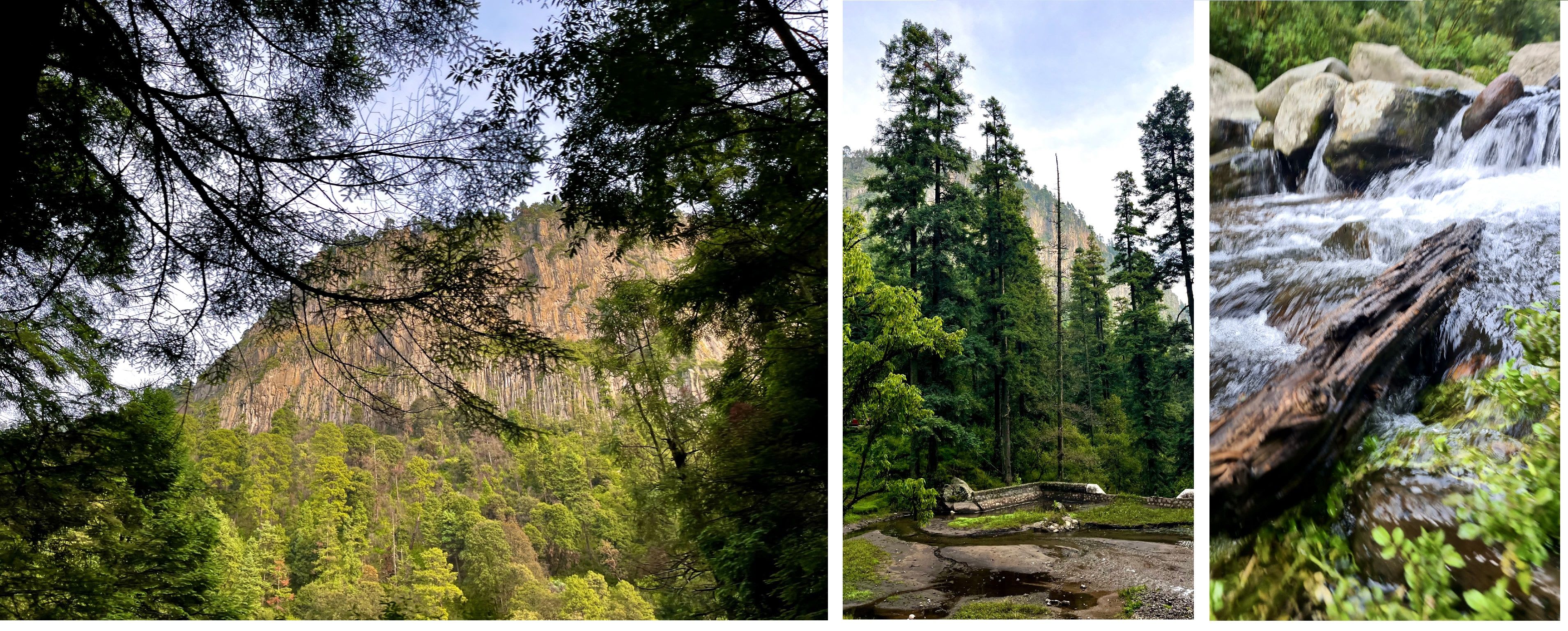
The route to get to the park crosses some neighborhoods of the city and before reaching the entrance you can see in front of you two walls of rocks and trees on both sides of the road, as if you were entering a gigantic gorge while the road begins to ascend. You can hear the running water on the right side of the path as you run through each of the sections or dynamos, each one higher up. Along the route you will find local restaurants, trout farms and outdoor ecotourism activities such as mountain biking, motorcycle rentals, rock climbing, horseback riding, hiking, camping and rappelling. Another tourist attraction is the fresh waterfalls along the river, which in some cases reach three and a half meters.
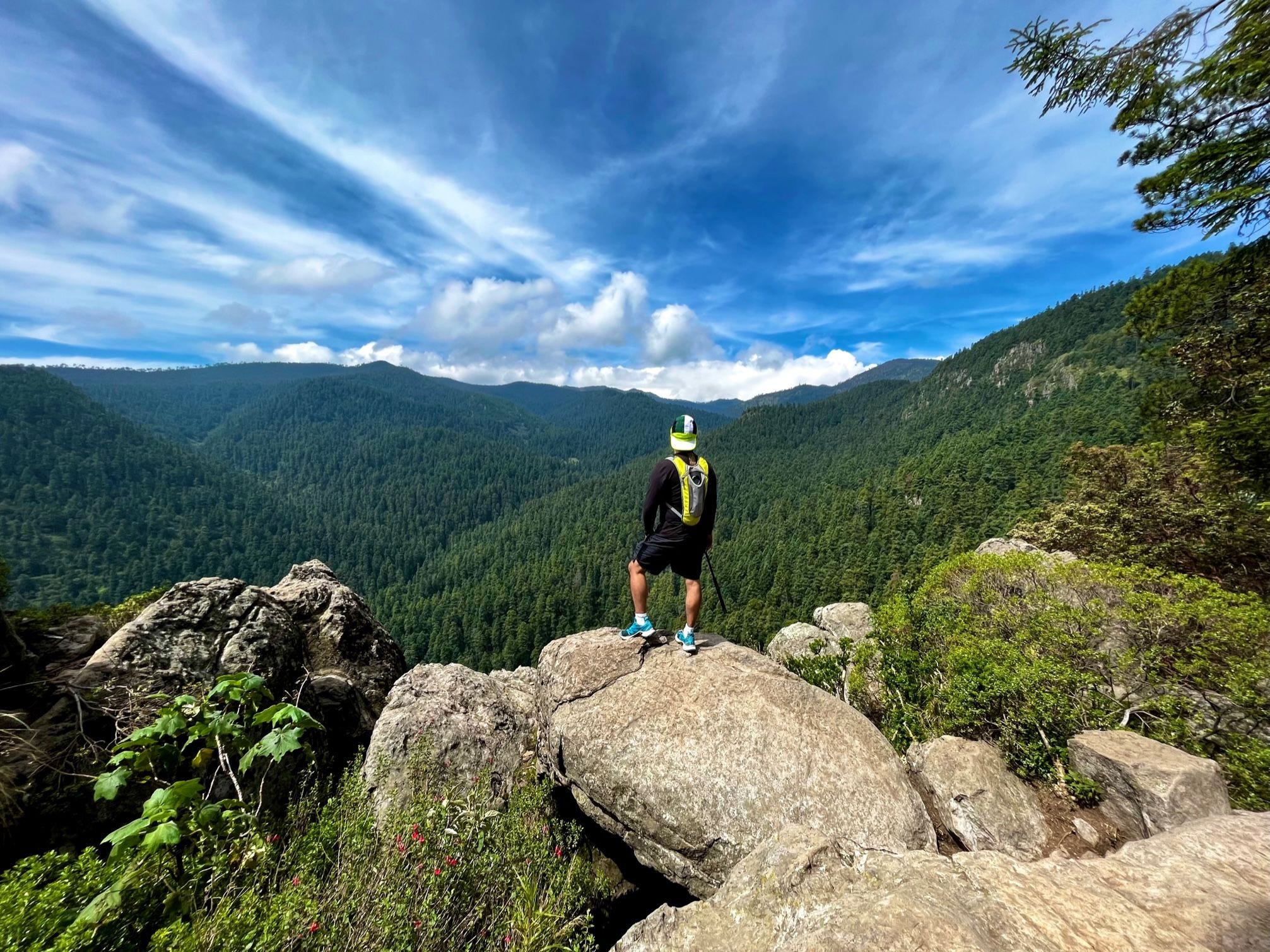
Our plan was to get to the parking lot of the fourth dynamo, located at 3091 meters above sea level (10,140 f.a.s.l.) and once there do a little jogging along the river to explore the place and the mountains that surround it. It's important to mention that this park has a network of ecotourism trails 26 kilometers long, so there are many routes to choose from and several viewpoints. When we arrived at the parking lot, I was impressed by a cliff that rose vertically to our right 300 meters from where we were standing: La Coconetla Ravine.
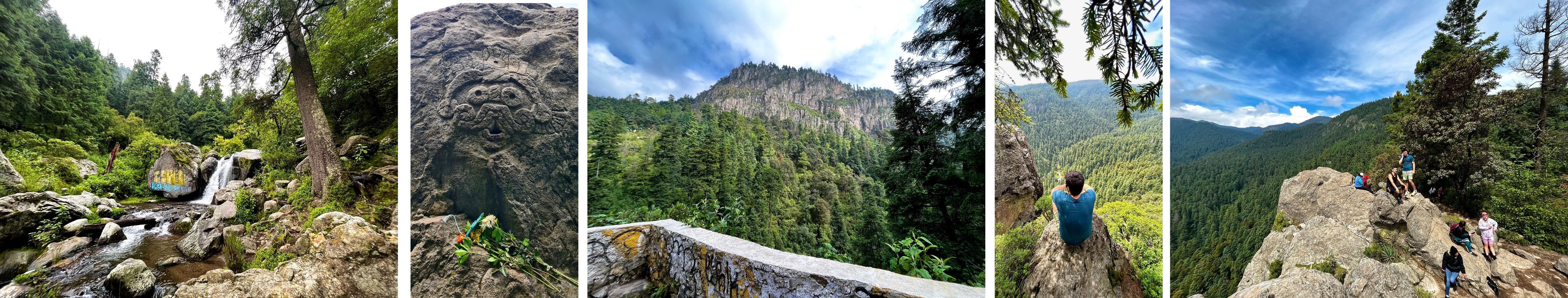
We started our tour along the river from the parking lot going up and down its sides and in the middle of the forest, enjoying the sound of rushing water and also small waterfalls that we came across. It is truly incredible to realize that just a few minutes from the city you can find these true paradises. On our route we also find some artificial channels that are intended to carry water from various natural springs in these mountains to other water boxes for distribution. Some times jogging and others walking we covered about 8 kilometers before returning to the parking lot again and we were able to enjoy beautiful views of the mountains that surrounded us. On our tour we were even able to find a geocache (GC7AMQD) that was placed in the area and it was very exciting to search for it as a team when we reached ground zero, and finally we managed to make the corresponding log, leaving a very funny gift in the cache, and returning to its hiding place (pretty sure some of you will easily understand this side achievement). The best was yet to come: we wanted to visit the viewpoint in the highest part of La Coconetla Ravine.

Starting on the fourth dynamo´s parking lot there is a paved path about 3 kilometers long with very clear signs that takes you directly to that viewpoint and allows people of all ages to reach the place to enjoy the view of the valley, although the road has a steep slope. I think it is important to share that this area was also inhabited by pre-Hispanic Nahua communities and in this region there were shrines to Tlaloc, the god of rain, due to the abundance of water in these mountain. Even one of the rocks in the viewpoint have a carved representation of this god, which is not a pre-Hispanic carving but much more recent. The name "Coconetla" means "mountain where there is plenty of water".
When you finally reach the viewpoint at the highest part of La Coconetla. you can only hold your breath at the beauty of the valley below. The height of the place also contributes to that feeling of immensity and smallness of your being, since you are facing a free fall of 300 meters (100 ft) to the parking lot. From that place you can see other important points of the city: the Ajusco volcano, the Xitle volcano, and the Teutli volcano.
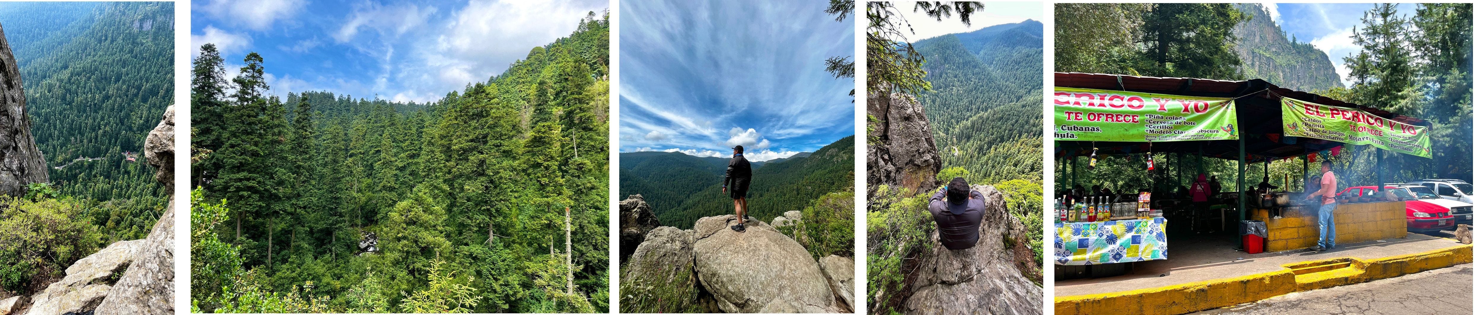
After enjoying those minutes of peace we began the descent, already very hungry and tired, but we knew that when we returned to the parking lot we could enjoy a well-deserved lunch to recover energy in one of the small local restaurants and return home.
Hills and cliffs, forest and river are located together where the Coconetla Ravine is born, where the Magdalena River flows, the last living river in Mexico City...